Geography of the Philippines
Discover the stunning archipelago of over 7,000 islands in Southeast Asia, where volcanic peaks meet pristine coastlines and tropical rainforests thrive
An Archipelago Like No Other
The Philippines stands as Southeast Asia's most remarkable archipelago, a collection of over 7,000 islands that showcase nature's incredible diversity across mountains, coastlines, and tropical ecosystems.
Location & Strategic Position
Located in Southeast Asia, approximately 500 miles east of Vietnam
World's 5th largest island country with 300,000 km² total land area
Gateway between Pacific and Asia providing vital sea routes for global trade
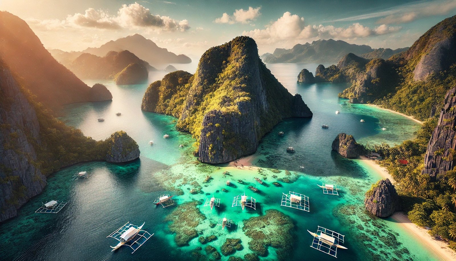
Philippine Archipelago
7,641 Islands in Southeast Asia
Satellite View
The Philippine archipelago from space
Three Major Island Groups
The Philippines is traditionally divided into three main geographical regions, each with distinct characteristics and cultural identities.
Luzon
The Largest Island
🏙️ Capital Region: Metro Manila
🏔️ Features: Mountain ranges, rice terraces
🌋 Volcanoes: Mount Mayon, Taal Volcano
📊 Population: ~57 million people
🏛️ Significance: Political and economic center
Visayas
The Central Islands
🏝️ Major Islands: Cebu, Bohol, Negros
🏖️ Features: White sand beaches, coral reefs
🎭 Culture: Rich cultural heritage
📊 Population: ~20 million people
⛵ Tourism: Major diving and beach destinations
Mindanao
The Southern Island
🌿 Features: Dense rainforests, rivers
🏔️ Highest Peak: Mount Apo (2,954m)
🌾 Agriculture: Major food producer
📊 Population: ~26 million people
🌍 Diversity: Multi-cultural communities
Diverse Landscape Features
🏔️ Mountains
Rugged mountain ranges across all major islands
🌋 Volcanoes
Over 50 active volcanoes including iconic Mayon
🏖️ Coastal Lowlands
Extensive coastlines with pristine beaches
🌳 Rainforests
Tropical rainforests with incredible biodiversity
🏞️ River Systems
Major rivers supporting agriculture and transport
🌊 Ocean Trenches
Deep ocean trenches including Philippine Trench
Rich Biodiversity Hotspot
The Philippines is recognized as one of the world's biodiversity hotspots, home to an extraordinary variety of flora and fauna, many of which are found nowhere else on Earth.
Biodiversity Hotspot
Rich ecosystem with endemic species
Geological Complexity
The Philippines represents a fascinating geological puzzle - a collage of different terranes and formations shaped by millions of years of tectonic activity.
Metamorphic Terranes
Ancient rock formations transformed by heat and pressure
Magmatic Arcs
Volcanic chains formed by subduction processes
Ophiolitic Complexes
Ancient oceanic crust exposed on land
Sedimentary Basins
Layers of deposited materials over time
Ready to Explore the Philippines?
Discover the incredible diversity of landscapes, from volcanic peaks to pristine beaches, and experience the natural wonders of this amazing archipelago.
Best Deals Available!
Find amazing accommodations with exclusive discounts
Instant confirmation • Free cancellation on most bookings